
Walk a Highland Park Street
Use a street directory as a chain. One source gives the stable parcel key, another gives recorded owners, and a third may place a named subscriber at the address. Lake County's assessor is the cleanest first stop because its result ties a street address to a Property Index Number, or PIN. Save the situs address, which is the physical site, apart from the taxpayer mailing address. They can differ.
- Search the Lake County assessor with only the address or PIN.
- Open the Tax Parcel Viewer and click the parcels beside it.
- Record owner, legal description, sale document, districts, and land use.
- Use the PIN or party in Official Records Advanced Search.
- Bridge older households through local directories and maps.
A tax mailing name may belong to an owner who lives elsewhere. A deed records a transaction, not every resident. Voter Power confirms one person who supplies authentication details; it is not a street roster.
Highland Park Street Search Fields
Basic Search tells users to submit one primary key at a time. Combining an owner, PIN, and address can cause a miss. Owner names use LastName, FirstName, and a wildcard can broaden a spelling. Test the plain number and street first, then add unit or direction.
| Field | Format | Purpose |
|---|---|---|
| Parcel ID | No dashes | Stable parcel key |
| Owner | LastName, FirstName; wildcard | Find taxpayer parcels |
| Address | Number, direction, street, unit | Start by address |
| Township | County list | Separate local contexts |
| City or ZIP | Form control | Narrow similar streets |
The advanced property form adds sale dates, year built, districts, exemptions, parcel status, and building traits.
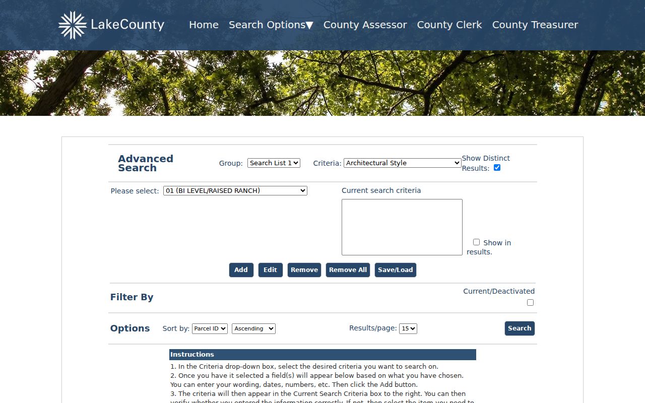
The captured controls show why a narrow address search and a broader street review should be run separately.
Map Highland Park Street Parcels
The parcel viewer adds shape and place to the tax roll. Search by PIN, address, or place, turn on Tax Parcels and Address Labels, then click next-door polygons. Do not assume consecutive numbers are consecutive homes. Ravines, railroad land, parks, rights-of-way, condominium common parcels, and public tracts interrupt a line.
Lake County launched new Maps Online in January 2026 and a rebuilt Tax Parcel Viewer in March 2026, so old screen directions may be stale. GIS answers mapping questions at 847-377-2373 and gis@lakecountyil.gov.
The GIS and Mapping page introduces the live tools and address work.
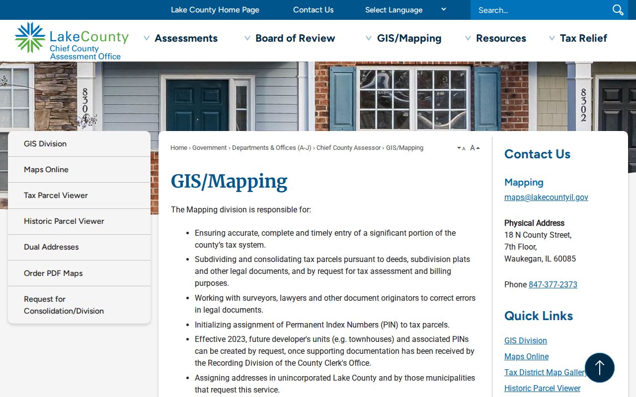
That page is the fallback when a map interface changes or a parcel needs staff review.
Note: A parcel card names a taxpayer or organization, not every person at a Highland Park address.
Highland Park Records by Address
No single Highland Park street directory holds every address fact. Match each question to its keeper and carry the PIN and legal description between systems.
| Record | Keeper | What it shows | Access |
|---|---|---|---|
| Property roll | County assessor | Taxpayer, situs, mailing address, PIN | Basic or advanced search |
| Parcel map | County GIS | Shape, legal text, nearby tracts, districts | Viewer or GIS help |
| Deeds | Recording Division | Parties, dates, sales, easements, plats | Web index, terminal, copy request |
| Permits | City of Highland Park | Work date, type, status, form names | Permit inquiry |
| Voter confirmation | County Clerk | One authenticated registration | Voter Power |
| Old directories | Public Library | Subscribers, occupants, old numbers | Digital, in-library, archives |
PIN joins assessor and deeds. Legal description can survive a number change. A directory places a listed person at one address in one year, while a permit dates work on the structure.
Deeds Along Highland Park Streets
The Recording Division's current index begins January 2, 1980. Advanced search accepts grantor or grantee role, PIN, city, township, lot, block, section, legal text, document number, dates, and type. A grantor transfers an interest; a grantee receives it. Deeds, liens, releases, covenants, easements, plats, surveys, and right-of-way maps can explain a street.
Find the present owner's purchase deed, inspect the image, and compare its legal description with the parcel card. The recorder warns that staff cannot conduct or guarantee a title search. Before 1980, handwritten grantor and grantee books carry the trail. Old instruments may omit a current PIN or address.
The recorded-land form displays the local search controls.
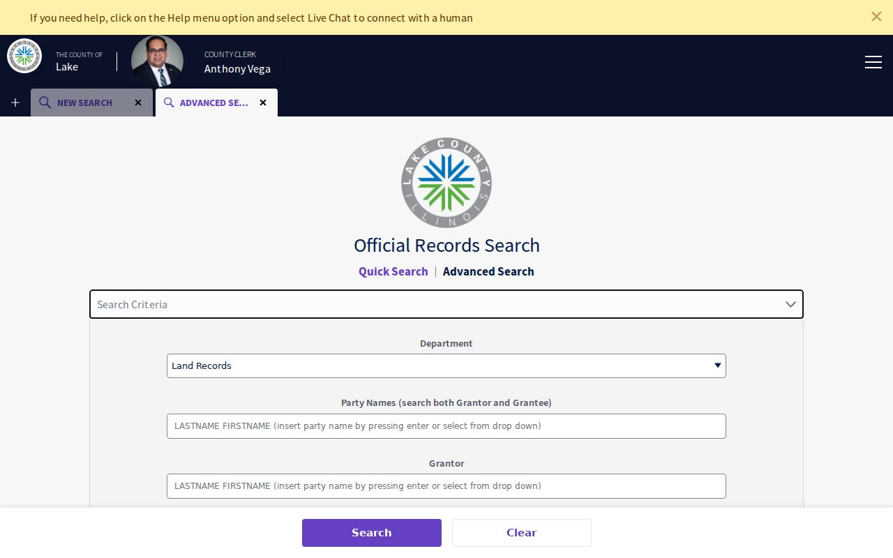
Its party, parcel, and document fields move the search from today's parcel to the instruments behind it.
Highland Park Street Record Fallbacks
When the web index fails, use the full access chain. Public terminals are on the sixth floor of the County Building, 18 N County Street, Waukegan, weekdays 8:30 a.m. to 5 p.m. Terminal searching is free. Copies are generally $1 per page and plats $5 per page. Request copies in person, by mail, fax at 847-964-5860, phone at 847-377-2575, or email at recorder@lakecountyil.gov.
The assessor or GIS office can clarify a PIN, boundary, or address. Illinois FOIA is available for a specific unpublished county record, subject to exemptions and special laws. Older address work may require library microfilm, in-library Ancestry Library Edition, or an archives request.
Note: A failed online result is a handoff to another channel, not proof that the record never existed.
Highland Park's 1950 Number Shift
Highland Park renumbered streets in October 1950. The library's newspaper index traces debate in 1949, a grid plan, notices to owners, and council action into 1951. It also records a County Line-to-Sheridan street-name change. This is the key historical street directory trap.
Make a number-bridge card. Record the old number from a 1919 or 1922 directory or Sanborn sheet, the later number, street-name forms, current PIN, legal description, and evidence page. Never use a simple digit substitution.
The library house-research guide connects directories, maps, tax files, and renumbering. Explore the collections on the Highland Park city directories page.
Highland Park Permits by Street
The City's permit inquiry accepts address, applicant or owner surname, dates, permit type, and status. A permit can establish when an addition, demolition, or repair entered city records. Search the exact unit and a street-only form when a multifamily address behaves oddly.
A permit dates work, not occupancy. Pair it with a parcel card, deed, directory entry, or dated newspaper item. The library guide also cites late-1920s building records, tax records from 1906, and a 1958 Moraine Township compilation with owner, house age, lot, description, price, permits, and photographs.
Highland Park Street Record Terms
Keep four labels distinct so a map or mailing field is not mistaken for proof of residence.
- Parcel
- A mapped tract identified by a county PIN. It can be public, shared, or nonresidential.
- Situs address
- The physical location, distinct from the taxpayer's mailing address.
- Plat
- A recorded map of lots, blocks, easements, or subdivisions.
- Criss-cross directory
- A book connecting an address or telephone number with a listed subscriber.
The 1919 and 1922 local directories are occupant-arranged, not simple street lists. Broader Waukegan and Evanston books may contain an early Highland Park address. A subscriber is not every household member.
Monitor Highland Park Property Records
Property Alert is a safety tool, not a resident roll. After registration, it watches a name, keyword, or legal description tied to a recorded image. The portal describes nightly or within-hours scans, one email account, and no stated alert-count limit. The county does not guarantee the third-party service.
The Property Alert page explains matching and registration.
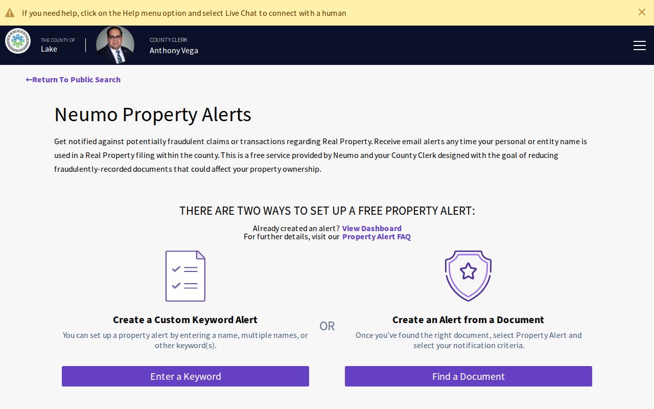
An alert only signals a match. Inspect the filing and contact the recorder if it looks wrong.
Limits of Highland Park Street Records
Public address records are incomplete by design. The assessor identifies taxpayers, not all residents. Deeds list instrument parties. Voter Power checks one registrant and does not publish a street roll. Utility accounts, motor vehicle addresses, renters, household members, and protected Address Confidentiality Program locations are not supplied through these property portals.
A current Highland Park street directory result also needs a time stamp. Assessor data can change after a sale, recorded instruments may appear before a tax roll is updated, and an old directory may preserve a person who moved long ago. Save the date searched and the date printed on each source. Where a taxpayer mailing address differs from the situs line, report both roles in plain words instead of calling either one the resident address.
Street names alone can mislead near city edges. Highland Park's municipal line, postal city, school district, and ZIP geography do not always match. Confirm the municipality in parcel GIS and use USPS for delivery questions. A 60015 or 60040 Census overlap is not enough to label a parcel Highland Park. The street directory should follow the parcel and official boundary, not a broad map label.
For personal family research, keep a small evidence log: source, search terms, result date, named role, address form, PIN, and document or page number. Mark conclusions as confirmed, likely, or unresolved. This method makes a by-street survey useful without turning uncertain clues into claims about a household. If the task shifts from a whole road to one named person, use the official role and date already found rather than expanding the search to unrelated private data.
Commercial directory products may blend stale files, shared phone plans, and inferred relatives. A Lake County street directory workflow is slower, but it exposes the custodian and the record that supports each connection. Official records identify a date, role, and limit. Verify names twice. Stop if the work turns into an effort to find a private person.
Use records lawfully. Highland Park address records support property research, genealogy, civic interest, and personal safety. Never use them to stalk, harass, intimidate, or harm anyone.